Real estate
Explore object identities, spatial relationships, construction milestones and handover records in a coordinated building model.

From intelligence and immersive spaces to the software and content behind them.
Explore solutions ↗Explore the people, applications and AI opportunities that shape your experience.
Explore industries ↗Custom hardware, applications and content connect education, market intelligence, corporate advisors and embodied AI.
Explore ai ↗Digital twins, BIM, AR/XR and the full 360° collection connect spatial information to meaningful decisions.
Explore digital twins ↗Paravision connects Building Information Modeling to real-time applications, digital twins, sales environments and spatial experiences. Our integration approach brings structured model information into interfaces that owners, project teams and audiences can actually use.
Discuss your project ↗A visual model becomes useful for BIM workflows when its objects, properties, relationships and information requirements are coordinated for the project.
Paravision’s role connects approved models and their information to visualization, application development, interaction and systems integration. Model authoring responsibilities and engineering approvals are defined with the design and project teams.
We plan how building information moves into the experience: which identifiers remain stable, which properties users need, how model versions are managed, and how interfaces connect to the approved source.
Rendering optimization preserves the agreed information mappings. A lightweight interactive model should still point back to the right asset and source record.
Rotate a conceptual building, isolate its disciplines and animate the construction sequence. Select an object to reveal the information an approved BIM model can connect to the experience.
Drag to orbit · scroll or pinch to zoom. All parts can also be selected below.
Columns and floor plates establish the building’s primary spatial framework. Select a discipline to inspect its role.
Explore object identities, spatial relationships, construction milestones and handover records in a coordinated building model.
Connect models to learning narratives, venue wayfinding, exhibition fit-out and explainable facilities information.
Bring approved foundation, road, substation and cable-route information into the same review experience as the wind-farm twin.
Procedural reference model, not a certified BIM deliverable. Demonstration object records and construction stages are synthetic. No live operational data is connected.
Two sector examples show how coordinated geometry and structured information become an interactive tool for project teams and audiences.
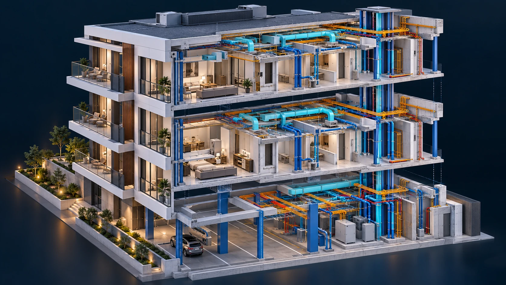
Illustrative BIM referenceReview aligned architectural and structural elements in the approved model.
The same visible building can carry object identities, properties and relationships that support design review, property presentation and asset handover.
Paravision optimizes the approved model for real-time use, retains agreed metadata mappings and creates web, multi-touch, sales-room or XR interfaces.
Optional AI can help users find and explain approved model attributes or related documents. It does not replace model validation, quantity verification or engineering approval.
 Illustrative BIM reference
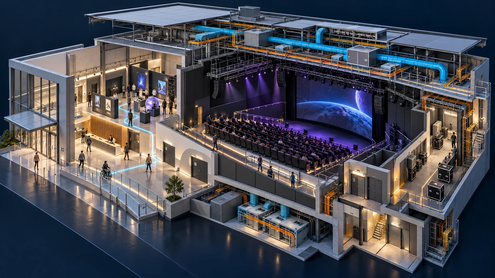
Review exhibition spaces, the lobby and visitor circulation in the venue model.
Immersive theaters, museums and entertainment venues need architecture, building services, AV equipment and visitor experience to work together.
Paravision connects the venue model to content planning, interactive software, display systems and immersive experience design as one coordinated integration scope.
Optional AI knowledge access can assist with approved equipment and venue documentation. Analytical conclusions are evaluated within the responsible specialist workflow.
These AI-created visual references illustrate potential integration scopes. They are not photographs of delivered Paravision projects, certified BIM models or engineering schematics. Data availability, model readiness, technical validation and delivery responsibilities are defined for each project.
Connect building, floor, space and unit information to interactive masterplans, visual comparison and property presentation. Align the buyer-facing story with approved project information.
Combine building-scale information with geospatial context and infrastructure relationships. Support stakeholder communication and planning review across the wider environment.
Bring model objects and metadata to multi-touch tables, kiosks, immersive displays and mobile interfaces. Let users select an element, understand its context and explore relevant information.
Prepare agreed asset attributes, documents and identifiers for owner-facing interfaces and digital-twin integrations. Establish how updates continue after handover.
Connect model views, approved project documents and issue context in a shared workspace. Coordination and analytical workflows follow the agreed specialist tools and project scope.
Optimize selected model views for spatial walkthroughs, guided explanation and collaborative review. Define scale, interaction, visibility and device performance before deployment.
Agree source formats, information needs, asset naming, coordinates, versioning and the intended audience. Review model quality before developing the interface.
Use agreed exchange workflows to carry geometry, object identities, properties and relationships between systems. Validate the data needed by the receiving application.
Optimize geometry, materials and scene structure for the target device while retaining the approved mapping between visible elements and source information.
Connect object selection, filtering, document access and operational context to intuitive web, touch and presentation interfaces.
Allow questions across approved model attributes and associated documents, with source references and project-specific access controls.
Provide application documentation, model-update workflows, operator training and a defined support route.
IFC is buildingSMART’s vendor-neutral standard for built-environment information, covering object identity, attributes and relationships. The exchange scope follows the project’s information requirements and is validated with the model-owning team.